The City of Surrey is hoping for the best but preparing for the worst in Bridgeview, as peak water levels rise across the province.
Flooding has forced thousands of residents out of their homes in B.C.’s southern Interior, and while Surrey officials aren’t sounding the alarm bell just yet, they’re bracing for the worst.
See also: Flooding forces thousands out of their homes in B.C.’s southern Interior
See also: B.C. flood watch to intensify over next week
“(Bridgeview) is definitely the area that could be most impacted by the rising levels,” said Jeff Arason, with Surrey’s engineering department.
“The projections provided by the province are changing daily,” Arason explained. “On Saturday the peak water level at the Mission Gauge for May 21 was estimated to be 6.89 metres and then re-forecasted (Sunday) to 6.39 metres. The latest projection is now forecasted for a peak water level at Mission Gauge of 6.64 metres on May 22.”
What does that mean for Bridgeview?
While the North Surrey community is protected by a dyke, the city begins to close the “stop log crossings” through the dyke at 6.5 metres, to help safeguard against a flood.
“It’s a mix of earth dyke as well as concrete, however with the dyke there’s a number of what we call holes for a lack of a better word,” said Arason. “We have roads and railroad crossings there. We have what are called stop logs, basically temporary walls we put in place to fill these dyke gaps.”
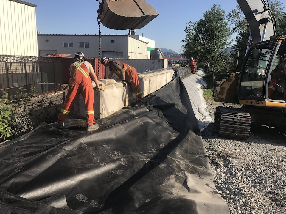
City crews were out this past weekend surveying the dyke and installing more than 500 concrete blocks and a waterproof membrane to reinforce it.
“By the time we’re at or around 7 metres, we want all the gaps to be filled,” said Arason.
The dyke, constructed in the 70s, has kept the community safe from flooding, he explained. Before that, a flood in 1894 had an estimated peak water level of 8.9 metres, and a 1948 flood had an estimated peak water level of 7.6 metres.
As the city does its work to protect against a flood, the Surrey Fire Department has also been preparing for the worst.
Over the weekend, staff visited the Bridgview community, going door-to-door to all homes within the dyke area, delivering packages with information and resources.
“We also did a survey to understand what the needs of the community will be… if we do have to evacuate,” said Deputy Fire Chief Mark Griffoen.
The city is hosting a public meeting this Wednesday (May 16) at 6 p.m. at Bridgeview Community Centre to update the community with the latest projections from the province and answer any questions residents may have.